
Use this hemisphere introduction to help your intermediate students build their geography skills.
This hemisphere introduction also gives a review of latitude and longitude lines.
Use this work to help students begin to build an understanding.
This is another free resource for teachers and homeschool families from The Curriculum Corner.
Focus on Hemispheres
When completing this work, students will work on the following skills:
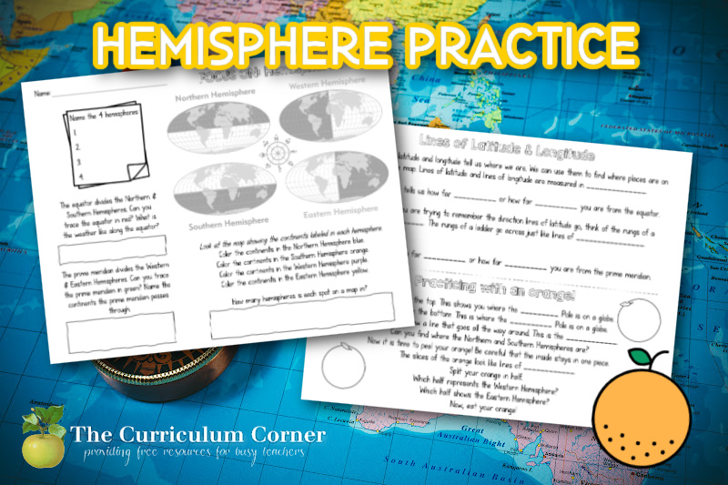
Name the 4 hemispheres: Northern, Western, Southern, and Eastern
Students will note that the weather along the equator is typically hot all year long.
The prime meridian passes through the following continents: Europe, Africa, and Antarctica
Students will note that each spot on a map is located in two hemispheres.
Lines of Latitude & Longitude
Lines of latitude and lines of longitude are measured in degrees.
Latitude tells us how far north and how far south you are from the equator.
The lines of latitude are like the rungs of a ladders. The rungs of a ladder go across just like the lines of latitude.
Longitude tells us how far east and how far west you are from the prime meridian.
Practicing with an orange!
Give each student a clementine or orange to work on the following:
The top is where the North Pole is on the globe.
The bottom is where the South Pole is on the globe.
The line that goes around the middle is the equator.
The slices of the orange are like the lines of longitude.
The left half is the Western Hemisphere.
The right half is the Eastern Hemisphere.
You can download the practice pages by clicking on the green apples below:


As with all of our resources, The Curriculum Corner creates these for free classroom use. Our products may not be sold. You may print and copy for your personal classroom use. These are also great for home school families!
You may not modify and resell in any form. Please let us know if you have any questions.